Water
The water balance across altitudes
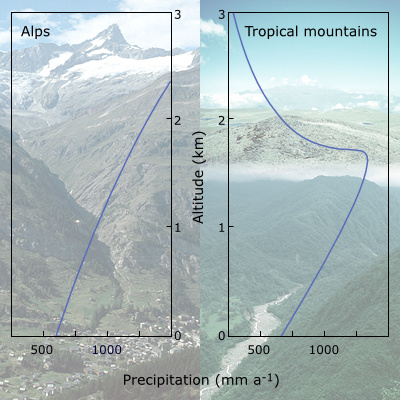
Outside the tropics, precipitation commonly increases with elevation. In the front ranges of the Alps, precipitation almost doubles between low elevation and 2500 m.
In some parts of the subtropics and tropics (such as in the Andes and in some African mountains) precipitation increases up to c. 2500 m and then declines rather abruptly, often resulting in high altitude semi-deserts. Central ranges receive less precipitation than frontal ranges, contributing to the so-called "Massenerhebungseffekt" (a drier and warmer climate in the center, such as in the Engadin and Valais in Switzerland).
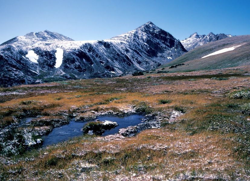
Because of the decreasing length of the growing season, evapotranspiration (the sum of evaporation from moist surfaces and plant transpiration) decreases with elevation, causing a surplus of water. A further consequence is that moisture rarely limits plant life at high elevation (except in very shallow soils).
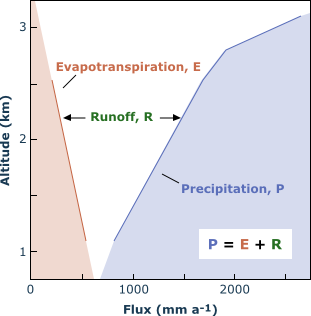
On bright summer days, evapotranspiration differs little between low and high elevation (3-4 mm d-1). Increasing precipitation and decreasing annual evapotranspiration lead to massive elevational increases in runoff in most mountains (e.g. from 200 to almost 2000 mm a -1 in some frontal ranges of the Alps, as for instance in the Swiss Grimsel region). This is why mountains are often called "water towers of the world". Enhanced runoff at high elevation increases the risk of erosion. Soil conservation becomes a particularly critical issue.
Note:
- Almost half of mankind depends directly or indirectly on water from mountains.
- Mountain biota rarely face water shortage, even if conditions look very dry. The more common problem is handling the water surplus (erosion!).
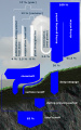
The pathways of water
The partitioning of annual precipitation to evaporative and runoff losses in an alpine grassland at 2300 m in the Alps.
- Most runoff occurs during snowmelt.
- Plant transpiration during the 10 week growing season has little influence on the annual water balance.
- Since 83 % of precipitation leaves the system by runoff, erosion risk is very high (need for intact plant cover).
